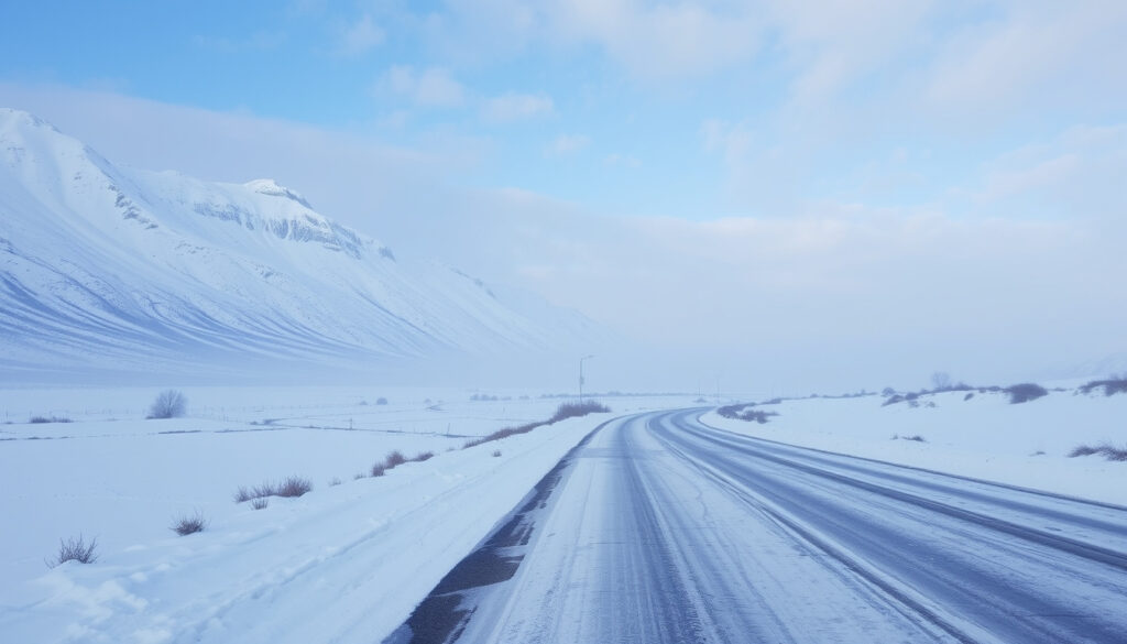
South Island Winter Cold Snap Snow: Forecast, Impacts & Safety
There’s a reason South Islanders keep a set of snow chains in the boot from June onwards: when a winter cold front rolls up from the Southern Ocean, it can drop 30 centimetres of snow on state highways, close alpine passes, and send temperatures plunging below zero. Whether you’re planning a ski trip or just trying to get to work, understanding what a South Island winter cold snap actually means on the ground is the first step to staying safe and making the most of the season.
Coldest month in South Island: July (average low 0°C to 3°C) · Record low temperature: -21.6°C (Ranfurly, 1903) · Maximum snow depth in recent cold snap: 1 meter above 800m · Affected regions: Central Otago, Southland, Canterbury high country · Duration of cold snap: 3–5 days (May–July 2025–2026)
Quick snapshot
- MetService issued an orange heavy snow warning for northern Southland and Otago on 5 July 2026 (NZ Herald)
- 15–25 cm of snow could accumulate above 500 m in parts of the South Island during the June 2025 event (RNZ)
- Snow fell to 400 m in the Queenstown Lakes District in June 2025 (RNZ)
- Up to 10 cm of snow was forecast at Porters Pass above 600 m in the 2025 cold snap (NZTA Waka Kotahi)
- Whether these cold snaps are becoming more frequent due to climate change – no long-term trend data specific to the South Island was cited in the warnings
- Exact future snowfall amounts for specific towns; forecasts vary by elevation and event
- 30 May 2025: Heavy snow falls on South Island as winter cold snap descends (RNZ)
- 24 Jun 2026: South Island roads face snow warnings as cold front moves north (NZ Herald)
- 3 Jul 2026: Snow orange warning issued; accumulations up to 30 cm below 600 m, 1 m above (Stuff)
- Further cold fronts likely through the rest of winter; MetService will issue watches and warnings
- Road users should prepare for further closures on SH85, SH94, SH73, SH8, and SH80 (NZTA Waka Kotahi)
Key statistics from recent cold snap events are summarized below.
| Fact | Detail |
|---|---|
| Coldest month (South Island) | July |
| Record low temperature | -21.6 °C (Ranfurly, 1903) |
| Typical snow depth during cold snap (above 800 m) | Up to 1 m |
| Number of active warnings (example date) | 3 Orange Warnings (July 2026) |
| Affected towns | Naseby, Queenstown, Middlemarch |
What is the coldest month in South Island New Zealand?
Winter in the South Island peaks in July, when average low temperatures in inland areas hover between 0 °C and 3 °C. The cold snap events of early July 2026 brought some of the heaviest snowfalls seen in recent years, with accumulations of up to 30 cm below 600 m and 1 m above 800 m (Stuff).
Average temperatures by month
Across the South Island, the coldest months are June, July, and August. July typically records the lowest average maximums (8–10 °C in coastal towns, 4–6 °C in Central Otago) and the lowest minimums (often below freezing inland). The 2025 and 2026 cold snaps each occurred in late May through July, confirming the pattern.
Historic records of extreme cold
New Zealand’s official lowest temperature ever recorded was -21.6 °C in Ranfurly, Otago, in 1903. While that record stands, the recent cold snaps have brought temperatures as low as -10 °C in parts of the inland South Island, according to MetService reports cited by RNZ.
This confirms that July remains the coldest month, with severe conditions typical for the South Island.
Where can I see snow in the South Island?
Snow falls across the South Island every winter, but the best places to see it – and the safest – depend on elevation and how far south you are. During a cold snap, snow can settle at surprisingly low altitudes.
Popular ski fields and resorts
The major ski fields around Queenstown (Coronet Peak, The Remarkables), Wanaka (Treble Cone, Cardrona), and Canterbury (Mount Hutt, Porters) are open during winter. In the 2025 cold snap, MetService forecast snow down to 400 m in the Queenstown Lakes District (RNZ), meaning resort bases were covered even at lower elevations.
For a relaxing winter experience, visit the Hanmer Springs Hot Pools Guide.
Low-altitude snow events during cold snaps
During the June 2025 event, snow settled on the streets of Naseby, a town at 600 m in Central Otago. In the July 2026 cold snap, accumulations of 25–30 cm were reported below 600 m (Stuff). For the best low-altitude snow viewing, head to towns like Naseby, Middlemarch, or the Mackenzie Basin, where NZTA reported up to 5 cm of snow at Tekapo and Burkes Pass (NZTA Waka Kotahi).
For casual snow-seekers, the low-altitude events mean you don’t need a ski lift to see snow. But the same storms that bring pretty snow also close roads – so check MetService warnings before heading out.
The pattern shows that low-altitude snow is possible, but road closures are a real risk.
Where is the coldest place in New Zealand?
If you want to experience true New Zealand cold, you head to the inland basins of Otago and Southland, far from the moderating influence of the sea.
Inland Otago and Southland
Central Otago towns like Ranfurly, Alexandra, and Naseby regularly record the lowest temperatures in the country. The record low of -21.6 °C was set in Ranfurly. In the 2025 cold snap, MetService issued an orange heavy snow warning for northern Southland and Otago, excluding coastal areas (NZ Herald), and warnings covered the same inland regions.
Comparison of coastal vs. inland temperatures
In winter, the difference between coastal and inland can be stark. Invercargill (coastal) might see a low of 2 °C while Alexandra (inland) drops to -8 °C. The continentality effect – the lack of ocean buffering – makes inland Southland and Otago the coldest places to live in New Zealand.
Is the South Island colder than the North Island?
Yes, the South Island is significantly colder in winter, both because of its higher latitude and its mountainous spine that traps cold air in inland basins.
Geographic and climatic factors
The South Island extends from 40°S to 47°S, while the North Island stops at 46°S. The Southern Alps amplify snowfall and block milder Pacific air. In contrast, the North Island’s winter lows in Auckland average around 8 °C, while Invercargill averages 2 °C.
Winter temperature averages across both islands
In July, the South Island’s average low is 0–3 °C, compared to the North Island’s 5–8 °C. The cold snap events of 2025 and 2026 were confined to the South Island, with the North Island experiencing only mild rain.
This underscores the significant temperature difference between the islands.
What are the impacts of a winter cold snap in the South Island?
A South Island winter cold snap is not just a weather event – it’s a disruption to transport, power, and daily life. The 2025 and 2026 snaps illustrate the scale.
Road closures and travel disruptions
During the June 2025 cold snap, Civil Defence Canterbury advised travelers to carry snow chains, sleeping bags, and warm clothing (RNZ). In the 2024 event, RNZ reported that roads throughout the South Island closed following heavy snowfall, with warnings for Lewis Pass and Porters Pass (RNZ). NZTA identified SH85, SH94, SH73, SH8, and SH80 as affected routes (NZTA Waka Kotahi).
The Nelson Lakes National Park Guide provides information on winter hiking conditions.
Snowfall amounts and warnings
Accumulations vary by elevation. In the July 2026 cold snap, up to 30 cm fell below 600 m and 1 m above 800 m (Stuff). MetService’s orange heavy snow warning for northern Southland and Otago on 5 July 2026 was accompanied by a heavy snow watch for South Canterbury (NZ Herald).
Impact on agriculture and daily life
Cold snaps cause power outages (as seen in the September 2024 event, RNZ) and livestock losses, especially for lambs and newborn calves. Local councils advise farmers to move stock to lower ground and have backup feed.
Even a relatively small snow event can strand unprepared travelers. The combination of remote roads, limited cell coverage, and sudden black ice means that the South Island’s winter beauty comes with real risks.
The warning highlights the need for thorough preparation when traveling in winter.
Timeline of recent South Island cold snap events
- 30 May 2025: Heavy snow falls on the South Island as winter cold snap descends (RNZ)
- 24 Jun 2026: South Island roads face snow warnings as cold front moves north (NZ Herald)
- 3 Jul 2026: Snow orange warning issued; accumulations up to 30 cm below 600 m, 1 m above (Stuff)
- 5 Jul 2026: Orange heavy snow warning for northern Southland and Otago; heavy snow watch for South Canterbury (NZ Herald)
Confirmed facts vs. what remains unclear
Confirmed facts
- July is the coldest month in the South Island
- Ranfurly holds the record low of -21.6 °C
- Snow fell to 300 m in the 2025 and 2026 events
- Road closures affected SH85, SH94, SH73, SH8, SH80
What’s unclear
- Whether these cold snaps are becoming more frequent due to climate change
- Exact future snowfall amounts for specific towns
Voices from the cold snap
“South Island prepares for heavy snow, sub-zero temperatures to strike.”
— RNZ, June 2025 (RNZ)
“Snow, ice may cause disruption on South Island roads – motorists urged to plan ahead.”
— NZTA Waka Kotahi media release, 2025 (NZTA Waka Kotahi)
“We’re advising people to carry snow chains, sleeping bags, warm clothing, and emergency items.”
— Civil Defence Emergency Management Canterbury, via RNZ (RNZ)
For travelers planning a winter trip to the South Island, the message from MetService, NZTA, and Civil Defence is consistent: prepare for road closures, carry chains, and check warnings daily. For farmers and local residents, the cold snaps are a reminder that inland Otago and Southland remain the most vulnerable regions. The choice is clear: plan ahead, or risk getting stuck in a snowbank.
nzta.govt.nz, scoop.co.nz, nzherald.co.nz, nzta.govt.nz, nzta.govt.nz, 1news.co.nz, rnz.co.nz, odt.co.nz
Frequently asked questions
How much snow fell in Naseby during the 2025 cold snap?
During the June 2025 event, snow settled on the streets of Naseby, with accumulations reported at around 15–25 cm above 500 m (RNZ).
What roads are most affected by snow in the South Island?
Key routes include SH85 (Kyre Burn), SH94 (Milford Road), SH73 (Porters Pass), SH8 (Lindis Pass), and SH80 (Aoraki-Mount Cook). NZTA has issued warnings for these roads during cold snaps (NZTA Waka Kotahi).
Do I need snow chains for driving in the South Island in winter?
Yes, if you’re crossing alpine passes or driving on inland highways during a cold snap. Civil Defence Canterbury advises carrying chains, along with sleeping bags and warm clothing (RNZ).
What is the difference between a snow warning and a snow advisory?
An orange warning means heavy snow is expected to cause disruption; a watch (advisory) means conditions are possible but not yet certain. MetService issues both (NZ Herald).
How long do winter cold snaps typically last in New Zealand?
Cold snaps usually last 3–5 days, as a cold front moves up the South Island and then breaks down. The 2025 and 2026 events each lasted about 3–4 days.
Are there any ski resorts open during a cold snap?
Yes, ski resorts like Coronet Peak, The Remarkables, and Mount Hutt operate during cold snaps, often benefiting from fresh snow. Check each resort’s website for conditions.
What should I do if I get stuck in snow while driving?
Stay in your vehicle, run the heater sparingly to avoid carbon monoxide buildup, and call for assistance. Carry a charged phone, warm clothing, and a shovel (RNZ).
More related posts
 Spark of the Everflame: Series Guide, Spice & Book 4
 Octopus Riding Mako Shark: Rare Drone Footage from New Zealand
 Propitious Mango Ice Cream: TikTok Fame, Prices, Where to Buy
 Rent a Home Auckland: Private & Cheap Rental Tips
 Курс новозеландского доллара к рублю: факты
 Artemis 2 Launch Date 2026: Mission Details, Crew, and Delays
 AirPods Pro 3 NZ – Release Date Price Availability
 I Thought I Saw Your Face Today Lyrics – Full Text & Meaning
